The A483 – everything you didn’t know you wanted to know about the road!
The A483 is a major route that connects England to many locations through Wales. While the northern end of the route begins at Chester in England and soon crosses the border into Wales, the road crosses back into England near Chirk before going back across to Wales near Llanymynech. At that point, it stays in Wales, travelling further south before linking with the M4 to reach Swansea.
Offering major junctions with other roads
Many A-roads are linked to from the A483, including the A48, the A5, and the A55. There are also several exit points for the M4, including at the southernmost end.
What is the total distance of the road?
If you were to go from end to end, you would travel 153 miles to cover the entire distance from Chester to Swansea.
When was the A483 constructed?
The original date is uncertain, but the road does appear in the 1922 Road Lists document, issued by the Ministry of Transport in 1923. This saw roads being classified by type for the first time, with the A and B roads we know today being labelled and created. This was the only time a list of roads was ever made available for sale to the public (it was woefully out of date by the time it was released, and so had limited usage).
Notable towns and sights along the A483
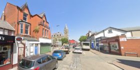
Wrexham is the first major town you’ll encounter after leaving Chester. Just south of the town you can visit Erddig, a National Trust 18th century manor, estate, and museum with charming landscaped gardens.
The road then crosses the River Dee, travelling further south and passing by Chirk before crossing the border once more. It continues through England for around 11 miles before crossing back into Wales.
The road passes through Welshpool, where you can exit to visit the National Trust Powis Castle and Garden. This stately home makes quite an impression thanks to its size and greenery.
From there, the road continues south, following the River Severn for a time before crossing it near Dolforwyn Castle (located on the right). The river continues as a guide before the road takes the Newtown Bypass to avoid the town itself. Further south it goes, eventually reaching Crossgates and heading west through Builth Wells.
It then connects to the A40 for a time before going back to the A483 close to Dinefwr Castle. Finally, it leads to the M4 which takes you into Swansea, a city on the south coast of the country. While the road skirts around the Brecon Beacons National Park, it still offers some pleasant scenery along the way.
Spotted something? Got a story? Send a Facebook Message | A direct message on Twitter | Email news@north.wales