Thunderstorm warning extended to cover large parts of North Wales
The hot weather looks set to come to an end today with thunderstorms set to hit large parts of Wales later today.
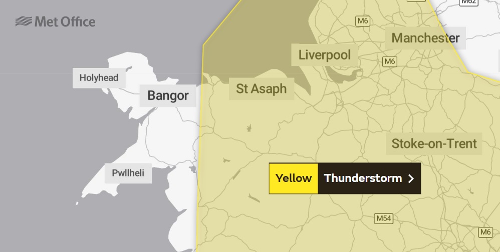
A yellow weather warning from the Met Office, which was initially issued yesterday, has now been updated to cover most of North Wales, with only western parts of Gwynedd and all of Anglesey not included.
The warning is in place from 10am this morning through until midnight.
Today will be the hottest day of the week, peaking at around 26C later this afternoon.
For those suffering with hayfever or not fans of the heat, temperatures are expected to drop tomorrow and over the coming days.
Forecasts differ in terms of when the rain and storms will hit Wrexham today, with the Met Office saying a 60% from around 7pm whereas other data shows that the band of rain currently passing over the UK could hit the region sooner.
Highs of 26C say the Met Office for today, with a yellow warning of thunderstorms still in place. They say 60% chance of rain 7-8pm. Other data says it is nailed on, and could come around 3-4pm… pic.twitter.com/TJIZfSGpbO
— Wrexham.com (@wrexham) June 23, 2022
The Met Office say: “Thunderstorms are likely to break out in some areas, particularly during the afternoon and early evening.
“While most places will probably miss them, where thunderstorms do occur there is a chance that in a few places up to 40 mm of rain could fall in an hour or so and 40 to 60 mm could fall in two or three hours.
“These torrential downpours may be accompanied by frequent lightning, whilst gusty winds and hail may also affect a few places.
“The exact location of the thunderstorms will be hard to pinpoint, so the warning area will be kept under review and updated if necessary.”
The Met Office is also warning that the thunderstorms and torrential downpours may cause travel disruption and, in a few places, flooding.
Spotted something? Got a story? Send a Facebook Message | A direct message on Twitter | Email news@north.wales